

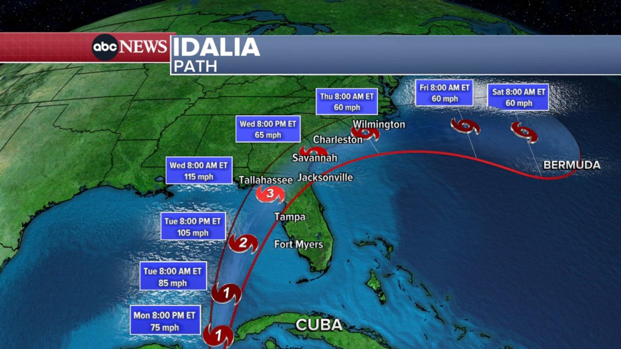
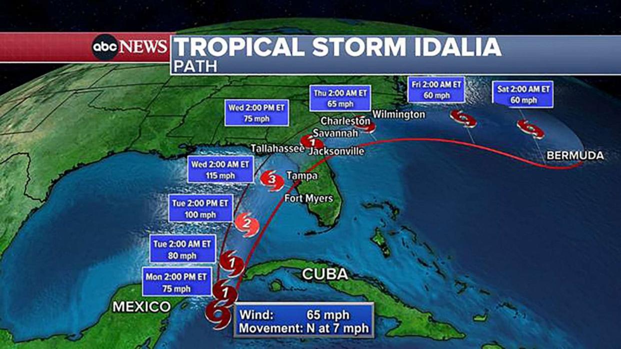
Tropical Storm Idalia is expected to strengthen to a hurricane as it bears down on Florida this week. The first major storm of the could become a major Category 3 hurricane by Tuesday night. Landfall is currently forecast for Wednesday morning in Florida’s Big Bend area, north of Tampa.
The Federal Emergency Management Agency is encouraging everyone in Idalia’s path to “get prepared today.”
FEMA Administrator Deanne Criswell spoke to Florida Gov. Ron DeSantis and “emphasized the agency’s actions and readiness to support the state’s needs.” FEMA is also “closely coordinating” with Georgia and South Carolina to provide support as needed.
The Tampa International Airport will close at 12:01 a.m. Tuesday as Idalia nears with a hurricane warning has been issued from the Tampa Bay area up to the Apalachicola area.
Storm surge is expected to be a major threat and could reach as high as 11 feet in the Big Bend area.
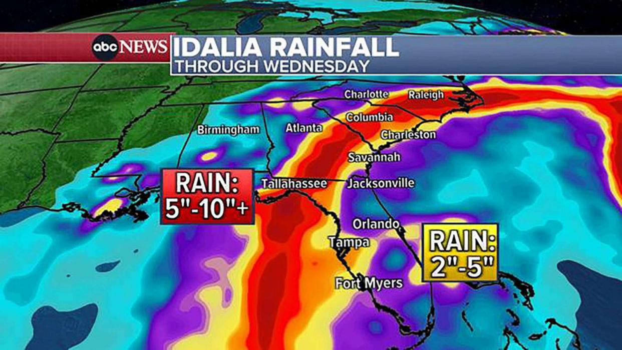
Up to 1 foot of rain could drench the Florida Panhandle and tornadoes are possible in Tampa and Orlando.
Idalia will move north Wednesday afternoon and evening, bringing heavy rain and potential flash flooding to Georgia and the Carolinas. Idalia will head out to sea on Thursday.
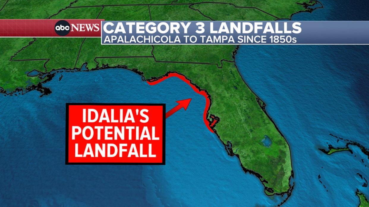
Believe it or not, Idalia could be strongest hurricane for Big Bend since 1950
Idalia is currently forecast to make landfall along Florida’s Big Bend region between Apalachicola and Tampa as a Category 3 hurricane. If this happens, it will mark the strongest landfall for the Big Bend region since 1950, when Category 3 Hurricane Easy made landfall in Cedar Key.
Floridians should prepare for at least Category 3 hurricane: DeSantis
Floridians should be prepared for at least a Category 3 hurricane, Gov. Ron DeSantis warned Monday.
“This is going to be a major impact,” DeSantis said at a press briefing. He also said evacuation orders will be issued for low areas along the coast.
If “you’re told to evacuate, you do not need to drive hundreds of miles. You do not need to leave the state of Florida,” the governor noted. “You basically need to go to higher ground in almost every instance. You can go tens of miles to a shelter, to a hotel, to a friend’s house, whatever works for you, and you’ll be able to ride out the storm.”
Storm surge is expected to be severe. It could reach 4 to 7 feet in Tampa and up to 11 feet in the Big Bend area.
Up to 10 inches of rain is possible in north Florida. Tampa Bay could see more than 6 inches of rain.
By Wednesday evening, Idalia will be weaker — a tropical storm — as it moves near the Carolinas with heavy rain and gusty winds. Idalia is not expected to impact the Northeast.